Saturday, May 28, 2016

Day 19 - “All this mud, that’s my poop” -Avarna

This was it. The day we had been waiting for. All of our training in hiking, climbing, spelunking and under-ground river crossing had led us to this day. Arising before the dawn (5:30 breakfast time to be exact) we embarked on our longest, most arduous field expedition to date. A two-and-a-half-hour bus ride found us at the entrance of a relatively untamed park, covered in dense rainforest, spotted with steep cliffs, and cut through the middle with an array of rivers and streams. We were off the edge of the map now, especially since Guil forgot to enforce rule number one today (Where are we?).

The past few days of excursion served us well as we traveled largely without incident through jungles, fields, and bamboo forests. Minor slips and skids found almost everyone on the trail as we tried to balance ourselves out and keep from falling.  Most of us didn’t make it out…
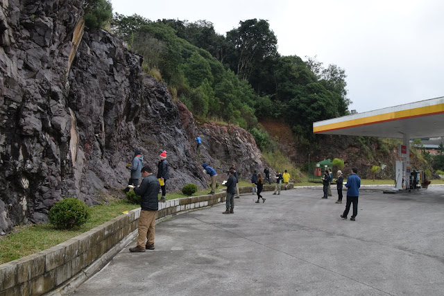
The end of the hike to the caves offered a spectacular view of a sinkhole, collapsed after years of slow erosion of the rock underlying the surface of the land. Descent into the sinkhole was followed by a quick measurement of the strike and dip (~ 205 degrees / 70 degrees northwest) of the rock features composing the wall of the hole, and a routine field lunch (ham sandwiches were replaced by salami today).


Then, it was time to go underground as we half slid, half stumbled our way down into the depths of the cave. We were immediately greeted by a variety of complex and beautiful cave formations unlike any we had seen before. At the base of these was another novel structure known as a travertine, a terrace-like formation composed of small grains of calcite, precipitated from the evaporating droplets of water dripping from the ceiling as they flowed over the cave floor. These travertines were particularly impressive to look at as water, disturbed by Avarna and Lydia, flowed over their steps to the large underground river below.

Next up was another part of the cave, where we found a large basalt dike intruding into the cave rock.  Interestingly, this dike strikes East-West, which is uncommon as most dikes in the region strike North-South, a characteristic feature of the East-West splitting of South America and Africa. The return trip to the trail through the cave involved several river crossings, which were handled expertly by the now well-adjusted students, instructors, and guides of the Maymester.

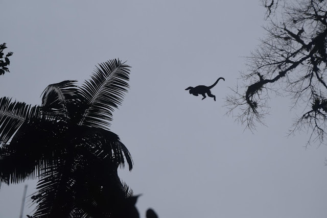
As we exited the mouth of the cave, we were met by a strange sound – a high-pitched whistling from one of our guides, Ditinho. The leaves of the canopy rustled, and a similar sound projected out from the tops of the trees. Three days of waiting and searching had finally paid off. It was a family of Capuchin monkeys! Everyone immediately rushed along the trail to the best vantage points to get a quick glimpse of the friendly primates. The hustle was well worth it, as the majority of the group witnessed the whole group of monkeys, including a mother with a baby wrapped around her chest, leap between the trees right above our heads.


The most notable aspect of the hike, aside from the amazing geological formations and the monkeys, of course, was Emanuel’s infamous mid-race face plant.  The guides who accompanied our group moved at a remarkably fast pace during this hike (we think they were trying to see if we could keep up), but after a bit of egging on by the Trio (Emanuel, XJ, and Matan), the race was on.  All of a sudden, the guides took off running and the rest of the group followed suit.  When Emanuel got the memo, his Olympic build took off running, but we learned today that mud beats man.  The mud was slipping out from under him so fast that he was literally running in place! After slipping in place about 5 times, he finally took a tumble into the mud.  It is safe to say that the Maymester students and TA’s were thoroughly defeated by the guides, but we put up a great fight.

After a long hike in wet boots and even wetter socks, plus a million pictures on Guil’s camera (don’t forget the second photo!), we finished the hike with smiles on our faces.  The hardest part of the trip was now over.

Reporting to you live from dinner,


Datan (Dan and Matan)

Friday, May 27, 2016

Day 18 – How Malu Are You?

Malu is still here, and so are we. Today the Queen Badass, otherwise known as Mufasa, headed our first real ecology lesson, creating individual plots of 1.5 x 1.5 meters in order to observe the jungle’s biodiversity. In pairs, we set out towards the forest and began classifying species, diversity, whether the species were dispersed or clumped together, and if there were any dominant plant types within our plots. Next, we worked on a transect with our partner (G-rated, I promise), taking 20 steps perpendicular to the trail behind, measuring the number of trees in our path and their diameters. This information hints at the relative ages of the trees, which informs us of the general age of the forest around us. 

Then, the party started. Our underground adventure included exploring two caves, one dry and one wet; but, first, let us talk about how these caves formed. As with most caves, this one was made of limestone, a sedimentary rock that is particularly susceptible to water erosion, much like the wicked witch of the west (I’M MELTING!). These caves formed when water started to dissolve the limestone, and as the water ran through the earth, the earth slowly moved upward, creating the cavernous pathways we trekked through.


Evidenced by a phenomenon known as an elephant’s foot, when a forming stalactite hits the water below and spreads out, forming a wide 3D puddle, we were able to identify how high the water level used to be. Our brains full of new knowledge, our bladders full of pee, and our stomachs full of nothing, we headed out of the cave towards the river to have lunch.


To end the day, we took a bath and a trip on our favorite rocket ship, flying through the tunnel of our second cave, assisted by chest deep water and a rope. Known as the wedding cave due to the numerous weddings held there, we all channeled our inner Tarzans (and Janes) to wade through the ice-cold river. As Jen froze to death, we each took a final plunge headfirst into the water, guided by the graceful hand of Ditinho and Malu, and emerged on the other side, baptized. Despite some head conks (we had helmets!) and busted lips, we made it safely and soundly to the other side.


Finally the day ended with several group photos, all in which the girls (obviously) one-upped the guys with their muscles. Here’s to our 5am wake-up tomorrow. Help.

And after a long day, it was clear we were all pretty Malu.

Kronk (Squesk squweakity squeak sqeak) and The one with the busted lip

Emmanuel and Virginia

Thursday, May 26, 2016

Day 17 – These Boots Were Made for Walking

Today we learned the true definition of a hike. After celebrating Malu’s arrival last night, we woke up bright and early, vastly unprepared for the day ahead. Until this point, we thought Guil had set out some pretty challenging treks for us, but the jungle is Malu’s kingdom and she set us off on a grand tour of everything the Atlantic Forest has to offer.

After a classic Brazilian breakfast of fruit, pastries, and ham and cheese sandwiches, we boarded our mammoth of a tour bus. Our destination: PETAR, a Sao Paulo state park that contains the largest continuous tract of the Atlantic Forest. Accompanying us were our three trusty native guides, who were incredibly well versed in the secrets of the forest.

As we set out on the trail it quickly became clear that we were far removed from the barren, rocky outcrops we had grown so accustomed to. The forest was an explosion of life and biodiversity. Every few minutes, our guides stopped us to point out some of the fascinating plants bordering the trail, from medicinal stalks and tangerines to selectively sharp tree branches, which could easily slice open an arm if rubbed the wrong way.  

 About an hour into our hike we came across a wide river, which we had to cross in order to reach our destination. With the help of our guides, we were able to traverse this monster, although we baptized most of the group’s boots in the process. We continued on the trail for a few kilometers, until we reached a massive cave entrance. A quick lunch followed and Guil finally brought us back to our roots by presenting us with some challenging questions about the surrounding rock features and their origin. In a departure from the igneous rocks of the past week, the stratification and fine composition of the surrounding rock led us to conclude that we were standing atop sedimentary limestone. We studied the structure of the cave exterior and observed that the layers of rock making up the cave entrance tended to fold down as it neared the cave’s opening. This is because that specific rock deformed in a ductile way, which allowed it to become curved in either direction. The folded rock also caused it to be easier to weather, which caused the cave’s opening to form.


Following an unnecessarily wet group photo (thanks Emmanuel!), we set out for the long trip home. The hike began with a desperate, grasping crawl up a steep hillside, followed by a much-needed downward slope. Finally, after one last river crossing, we reached our home sweet bus, slipped out of our soggy boots, and piled in. We returned home a little wetter, and much more exhausted, but with a new appreciation for both the bountiful forests of Brazil and the geological gems hiding inside.


Rainforest Ryan and Not So Dry Nick

Days 14-16 - Beaching and Moving

Days off in Florianópolis and a day driving to PETAR...

Wednesday, May 25, 2016

Day 13 - The Final Countdown

A 7:30 wake up. An 8 AM breakfast. A 5 minute car ride. 

And then it was time. Time for the final exam. 

Apparently, our PhDs had arrived in the mail that morning, because Guil kept repeating that "WE were the geologists". He and Lydia removed their scientific hats for the day, softly placing them on our unassuming undergraduate heads. 

Our task was simple. Describe the entire many-million-year formation process of the geological features of a 200-meter section along the Torres coast. Straightforward enough, right? 

We arrived at Parque da Guarita on the Southern coast of the state at about 9:20 in the morning. Three vast expanses of outcrop stood before us. How on Earth are we supposed to interpret all of this? "You have 5 hours," Guil said forebodingly. 

Oh. Well upon first examination, 5 hours seems like enough time. But many of us worked up until the last second, some even skipping lunch, in an attempt to flesh out a logical prediction. Examining, feeling, and even tasting the rock, we filled our field journals with observations and hypotheses as to what was happening back in the Ol' Cretaceous period. 

After a rainy and overcast afternoon (foreshadowing for our grades), we returned from the park to the hotel where we shed our wet clothes and tidied up before the formal part of the exam. 

What ensued next was undoubtedly the quietest 4 hours of the Maymester thus far. In an SAT-like setup, each student claimed a desk to themselves where we slaved away until the 7pm deadline: drawing sketches, balancing theories, and stressing out. 

Finally, as the clock tolled 7, we handed in our papers with our fingers tightly crossed. Guil and Lydia gathered us around for the reveal. With their geologist hats back on, they explained to us their interpretation of the history.

These unusual outcrops were filled with surprises! Basalt/sandstone breccias, sandstone dikes, and dunes just to name a few. Guil and Lydia revealed the likely succession as follows: a sandstone or breccia layer, covered by a basalt flow, followed by more breccias in some places, and finally another basalt flow on top. Groans and celebrations sprinkled the crowd with each explanation as Guil revealed the likely origins of the features.

It'll be a few days until we all get our grades back. But until then, we'll be crossing state lines back to sunny Floripa to enjoy another calm, peaceful free day of absolutely no shenanigans nor mishaps.

On the lookout for good Wifi for GoT,
Carsen Targaryen and Grant Snow

PS: We will be away from internet for a few days, but we will update the blog as soon as we can! 


Monday, May 23, 2016

Day 12 - Blood, Gas Stations, and Highways

Today, we departed from Cambara do Sul. We started out with bright eyes of hope for our newest steed, Newgene. Unfortunately, this only lasted until our second outcrop, as the life of Newgene was cut far too short by faulty gears.

The first outcrop Guil brought us to was Blood Outcrop - affectionately named so after Guil once lost a fight with its rocks. We climbed through tall, thick grasses only to find - you guessed it - more pancakes. Then it was #1 TA Lydia vs. Rock, as she graciously tried to break off samples for us to look at and take back to their lab. Fortunately, Lydia won, and we used those samples to learn about how the outcrop formed. Around 135 million years ago, an explosive eruption created these deposits of igneous rocks and Barbosas (the pancakes) for us to admire and Guil to shed blood on. Barbosas are explosive blobs that are deposited when volcanoes erupt. They are more cohesive magma blobs that are not blown apart during eruption (unlike the torn apart matrix around them). They become progressively squished as you look down the outcrop due to compression forces. Barbosas are certainly a favorite of our group.


Fast forward to Newgene's death at the next outcrop and the biggest showdown the Maymester has seen since the Sand Dunes Incident of 2016. With our backs to a gas station, we were faced with the swirliest outcrop so far. The rift in the group started with Guil and Lydia's metaphorical descriptions of the outcrop. Did it look like toothpaste, as Guil suggested, or like pudding, as Lydia explained? After a quick lunch break and an hour of difficult sketching, we launched into our debate. It was Team Guil vs. Team Lydia. Team Guil believed in the Barbosas. This was an explosive outcrop, highly deformed post-deposition. Team Lydia, on the other hand, liked to think Team Guil had been fantasizing about pancakes for far too long. Team Lydia took a more effusive route, thinking that this was a part of a dome structure. After literally hours of debating, much frustration, and an officially pronounced dead Newgene, we headed off to our next outcrop. 


A couple hours later at sundown, while leading our convoy down the mountain, Guil veered off the road for one last stop. Naturally, within five minutes of us crawling out of the vans, it began to rain. While this led to a slight drop in group morale, Guil assured us that nothing could stop geology from happening. To Ali and Jen's dismay, the group was led by Guil (safely) down the side of the highway. There we met two types of rocks - obsidian and rhyolite. Guil asked us which rock was deposited first, almost beginning a new Great Debate. Fortunately, Sam saved the day by shouting out the wrong answer immediately, causing Guil to give us the less-than-obvious hint that the rhyolite did in fact come first. Turns out, we were looking at an obsidian dome that intruded into the rhyolite, as evidenced by the rhyolite inclusions within the obsidian. Satisfied with finally getting a straightforward answer, we headed back to the cars to continue on our way to Torres.

We were not greeted with an outcrop in Torres, but instead our friend Pablo with Newgene 2.0! Hopefully Newgene 2.0 can survive Guil's crazy road trips for the next couple of days.

Rock on,
Sam & Ali 

Saturday, May 21, 2016

Day 11 - RIP Eugene

On this fine Cambará do Sul day, we started out with a hearty breakfast at our homely hotel. Our goal for the day: go to the Itaimbezinho Canyon in the national park and try to figure out what actually happened 135 million years ago to form the rocks there. But first, we were struck with a death in the family, as one of our trusty steeds, Eugene, kicked the bucket on the dirt road to the national park. After we paid our respects, we rearranged into the other three cars and made our way to the canyon.


As soon as we arrived at the parking lot, Lydia took off gleefully skipping down the yellow brick road toward the canyon. There, we made observations for the next couple hours, and individually attempted to hypothesize the types of eruptions that created this colossal canyon. There was one very clear horizontal band that showed a break in eruptions, but what else was the canyon wall trying to show us? After this independent deliberation, we proceeded to have yet another glamorous field lunch of meat and cheese sandwiches complete with cucumbers, tomatoes, and a cuddle puddle for Guil’s camera. As soon as the perfect family photo was captured, we brought our deliberations together and compared them to Guil’s best guess; he thought that there were three major bands of rhyolite eruptions, with a basaltic layer at the bottom of the canyon. Additionally, we hypothesized that the middle band of rhyolite was formed by a series of explosive eruptions, but the top layer displayed elements that did not represent either an effusive or explosive eruption, although there were clear signs of effusive eruptions in the paths we walked on.


We put that layer under the table for now and took an extremely odd turn for the afternoon: ECOLOGY! Ecological and yoga guru Jen took the helm at full steam, and formed us into groups of two. She shooed us into the nearby pasture where we picked plots of 1.5 by 1.5 meters and counted the species of flora within those plots. We also had to describe the distribution of each species, as well as a general physical description. Then, after talking about how cows wrecked the flora in this pasture, we proceeded to do the same exercise in the nearby forest, where there were at least four times the flora species present in the plots. We saw how the presence of trees in this forest not only added another species, but also created an entirely new ecosystem for several plant species to survive in. After this short ecological exercise, we walked back to the beginning of the canyon and saw the waterfall and how it continues to actively expand the canyon. As the water eats away at the canyon wall at the base of the waterfall, it is weathering the rock to the point where eventually, the cliff face above it will collapse into the canyon below, creating a wider canyon.

When we got back to the hotel, we were greeted by a surprise: a new steed, the same model as Eugene (but with a radio!) was waiting for us. Affectionately dubbed “Newgene,” this car will join us for the last two weeks of our geological and ecological excursions in Brazil.

Andrew and Nathan